Solipsys sales
Collins Aerospace delivers operator-focused Command and Control (C2) software, enabling superior correlation and fusion of air, land and maritime sensors across the modern battlespace.
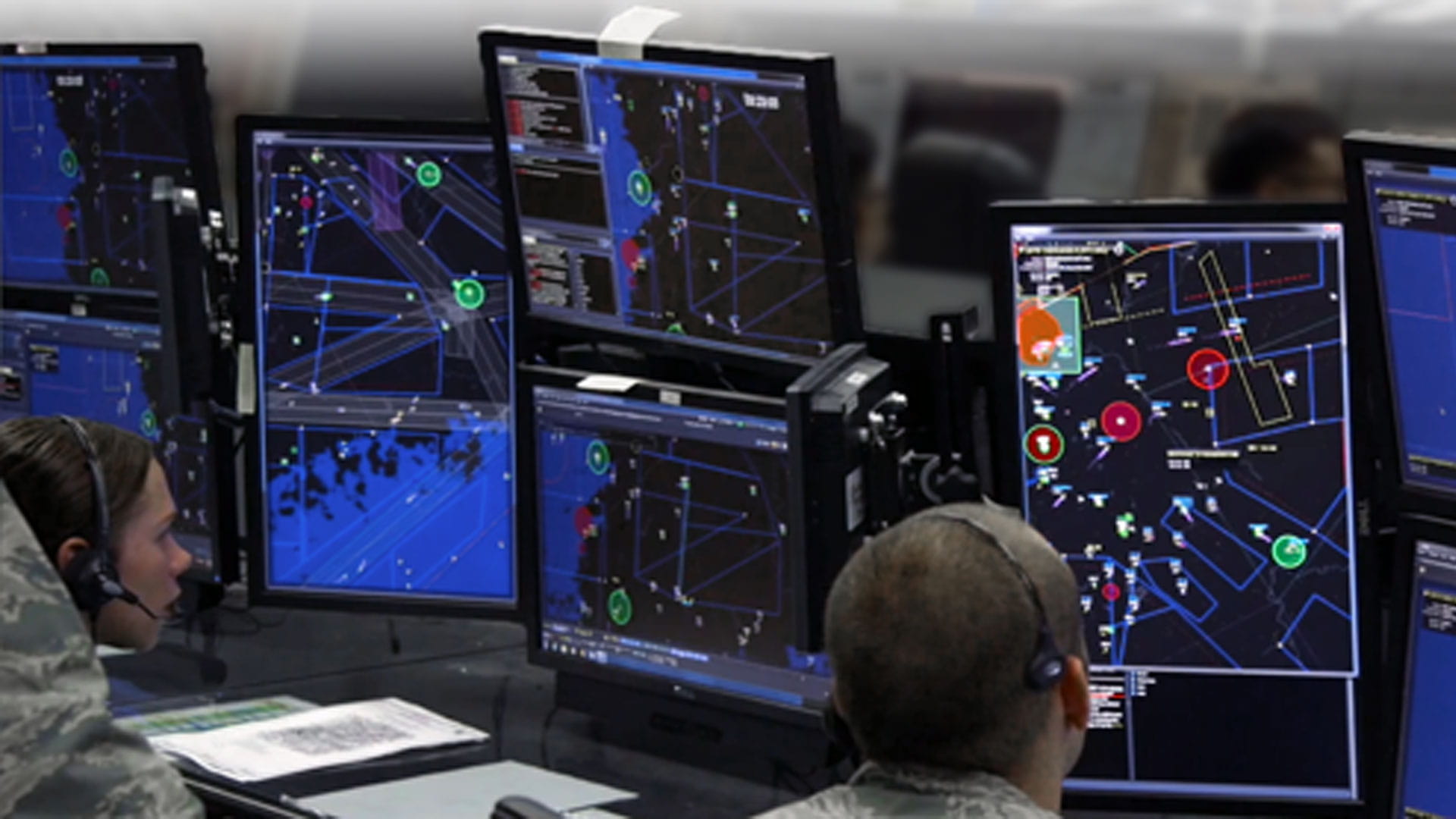
Battlespace Command and Control Center (BC3)
The Solipsys Battlespace Command and Control Center, or BC3, is advanced, multifunctional battlespace management software designed to meet unique mission program requirements and customer preferences. The Solipsys BC3 features a Technology Readiness Level (TRL) 9 rating, is Link-16-certified, and serves as a high-performance, C2 Commercial Off-the-Shelf solution.
Supporting a fully integrated and configurable defense architecture and a wide range of capabilities to improve and enhance battle management, BC3 excels at the execution of operational and tactical mission sets.
Its core software – consisting of the Multi-Source Correlator Tracker (MSCT) and the MSCT Display – is a program-of-record platform for the United States Air Force’s Control and Reporting Center, as well as the United States Marine Corps' and the United States Navy’s Common Aviation Command and Control System. Solipsys BC3 also serves as the core execution software for a number of international customers, including UAE, Australia, Qatar, Taiwan, Ukraine and many more. Each of these systems has tailored user interfaces that meet each customer’s specific needs.
When deployed, BC3 affords customers the following benefits:
- A single, integrated Battle Management System
- Reduced manning requirements
- Ability to easily plug in new sensors and effectors
- Integrated fire direction
- The ability to create a Common Tactical Picture (CTP)
- Automated processes and dissemination of data
- Reduced latency in kill chain
- Coalition interoperability
Multi-Source Correlator Tracker (MSCT)
As part of the Solipsys BC3 software configuration, the MSCT serves as a hub for managed processes that work in concert to create a fused, composite view of the battlespace – views that can then be used to communicate actions.
MSCT’s data correlation and fusion engines normalize and integrate measurement-level and track-level data from hundreds of different sensors and data links and then provides a single integrated picture (SIP) to numerous output interfaces, making it a highly capable system integrator. Real-time data received from tactical sources is routed to the correlator tracker to be fused and formed into the SIP. This data is further separated as detection/observation plots, transponder returns, tracks or EW artifacts.
Non-real-time data bypasses the correlator tracker; however, it may ultimately be associated with the SIP. Data is converted to normalized formats for processing by the correlator tracker, which can process unassociated measurements, associated measurements, tracks and bearings.
MSCT Display – built on Tactical Data Framework (TDF)
Also part of the BC3 software package, the MSCT Display is a performance-oriented, component-based visualization system that aligns with our Tactical Display Framework (TDF). MSCT Display provides unprecedented flexibility for developers and end-users for demanding applications, such as:
- Command and Control
- Air traffic management
- Missile defense
- Wide-area surveillance
- Emergency response
- Disaster management
- Air base air defense
- Integrated fire direction
- Distributed mission operations
Athena (Maritime Domain Awareness)
Athena provides enhanced maritime surveillance and control capabilities to enable true multi-domain operations. With integration of maritime sensors and data links, Athena can provide a comprehensive common tactical picture. In maritime environments, Athena offers the following features and functions:
- Tools that can:
- Monitor time, altitude and distance between objects (tracks, points, overlays)
- Raise alerts on defined events (e.g., track entry to exclusion zone or loss of track)
- Display track history and search the database for International Maritime Organization (IMO) numbers
- Automatically associate IFF/SIF data to ATO mission and mission-based operator task checklists (e.g., SAR plan of action)
- Creation of the integrated surveillance picture, combining cooperative and non-cooperative sensor sources and agency data from land, sea, air and space platforms
- Timely and accurate track identification with planning data, chat messages and track amplifying information displayed on multiple user consoles, using commercial network protocols.
- Display of charts, maps and images in a layered background
- Surveillance, monitoring and control of coastal areas, ports, harbors
and waterways and the associated airspace in support of operations, such as:
- Harbor security
- Vessel tracking
- Coastal surveillance
- Economic Exclusion Zone monitoring
- Flight incursions
- SAR and anti-smuggling operations
- Automated, doctrine-logic, engine-enabling operators to automate critical system functions, such as alerts and track identification plans
- Decision aids to implement automated alerts and early warning indicators to support response initiation, including asset coordination and tasking
- Automatic de-correlation of source tracks that had previously correlated, but whose kinematics or attributes are no longer consistent with those from a single target
- Data retention and position prediction for tracks that are no longer reported by any source
- Aids to support search and rescue missions, such as Four Whiskey Grids, altitude de-confliction and terrain contour charts
Related
Reference GSA Multiple Award Schedule (MAS) (Solipsys: 47QTCA21D001K)